


Filters

Stock vector images of Terre
Discover royalty-free, professionally-designed vector art of Terre for personal and commercial use.

Two globes representing the Earth and a planisphere
Globe icon with smooth vector shadows and white map of the continents of the world

Green earth

North America Vector Doodle on paper

Vector illustration of historical monument around earth

Multicultural children on planet earth

Vector illustration of a children ih the world
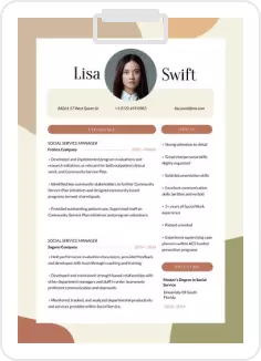
Business logo
Business logo

Vector Illustration Of Earth Day
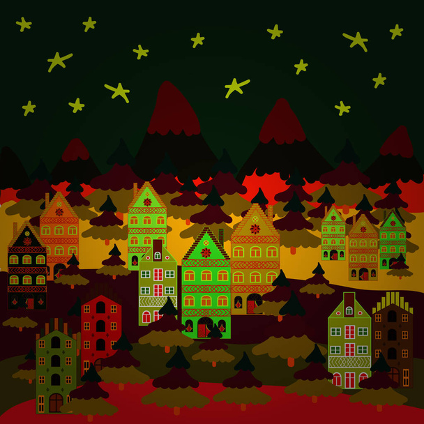
Creative christmas background. Vector illustration. Landscape with winter houses, wood, trees, hills on gray, brown and red colors.
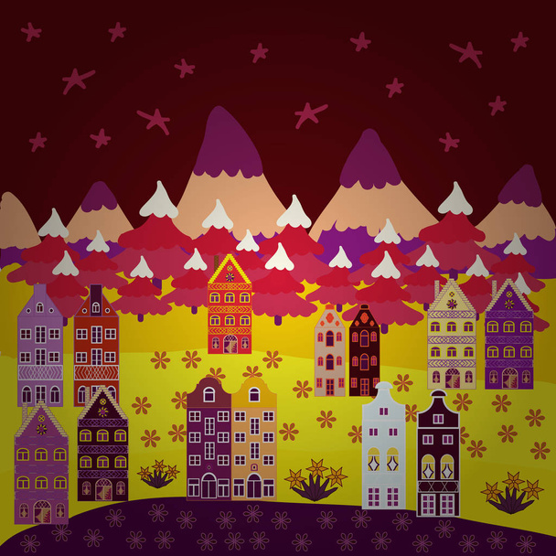
Christmas illustration on red, yellow and purple colors. Winter. Lonely house on a hill. Mountain landscape. Cloudy winter landscape. Vector.

Colorful houses. Vector illustration. Background with cute buildings on yellow, neutral, violet, blue and green colors. Angels.

Vector illustration of a children

Vector illustration. Colorful houses. Background with cute buildings on purple, blue and violet colors.

Woman silhouette with roots on white background

Colorful houses. Vector illustration. Background with cute buildings on blue, yellow and green colors.
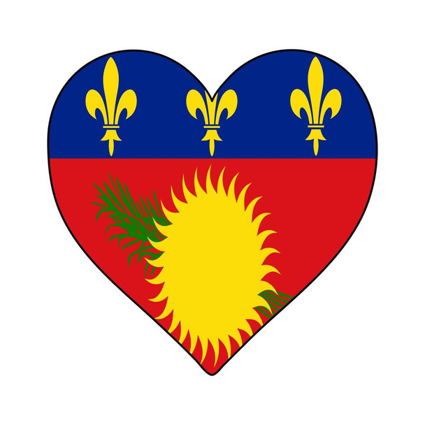
Flag of Guadeloupe from brush strokes. Flag Guadeloupe on transparent background for your web site design, logo, app, UI. Overseas department of France. Stock vector. EPS10.

Colorful houses. Background with cute buildings on brown, red and green colors. Vector illustration.

Vector illustration of Potato chef cartoon giving thumb up

Leeward Islands, gray political map. Part of Lesser Antilles, north of Windward Islands in the Caribbean. Virgin Islands, Anguilla, St Kitts and Nevis, Antigua and Barbuda, Montserrat, and Guadeloupe.
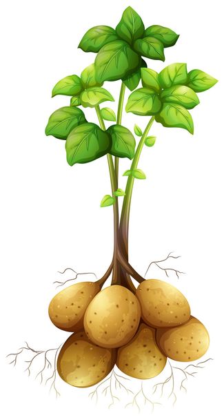
Potatoes with the stem and leaves illustration

Root and Tuberous Vegetables, Illustration Hand Drawn Sketch of Fresh Yacon or Smallanthus Sonchifolius Plant Isolated on White Background.

Illustration of a children set

Italy, Cinque Terre city skyline isolated vector illustration. Italy, Cinque Terre travel cityscape with landmarks

Paper art carving. Vector illustration. Paper art of happy new year house with on blue, red and white colors hills.

Cartoon Land Shark
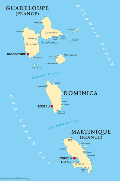
Guadeloupe, Dominica and Martinique political map with capitals Basse-Terre, Roseau and Fort-de-France. Islands in Caribbean Sea and parts of Lesser Antilles. Illustration. English labeling. Vector.
Countries of Europe

Liguria official regional flag and coat of arms, Italy, vector illustration
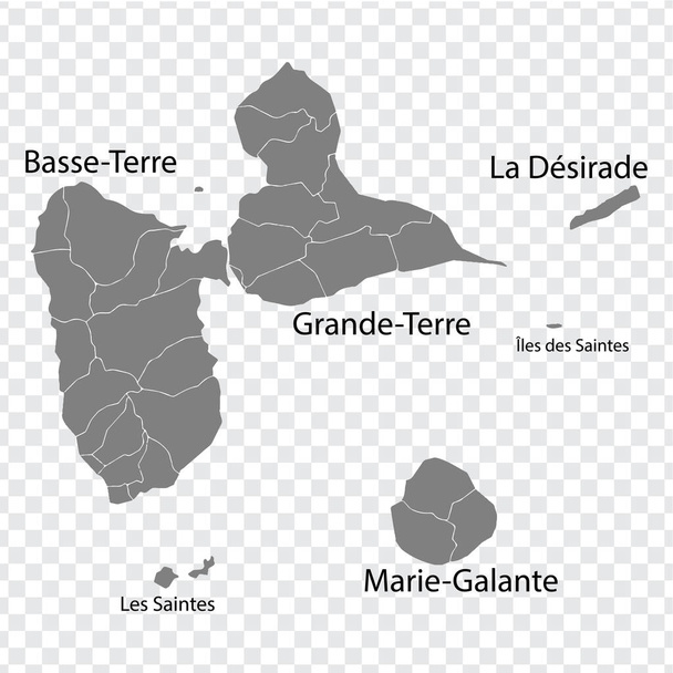
Blank map Guadeloupe in gray. Every Island map is with titles. High quality map of Guadeloupe with districts on transparent background for your design. Caribbean. France. EPS10.

Abstract bright background with globe

Fried potato fast food in bright red packaging
Curacao Heart Shape Flag. Love Curacao. Visit Curacao. Caribbean. Latin America. Vector Illustration Graphic Design.
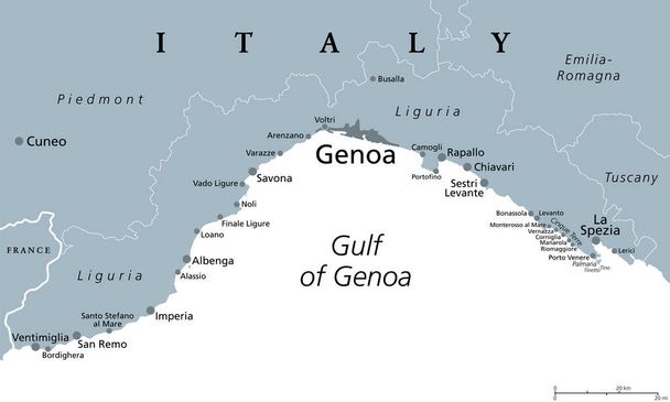
Liguria and the Italian Riviera, the Ligurian Riviera, gray political map. A region of north-western Italy, with capital Genoa. Coastal strip between Ventimiglia and La Spezia, on the Gulf of Genua.
Blue map of Guadeloupe, Caribbean islands. Archipelago and overseas department and region of France. Urban area cityscape vector illustration.

Made in Basse-Terre rubber stamp
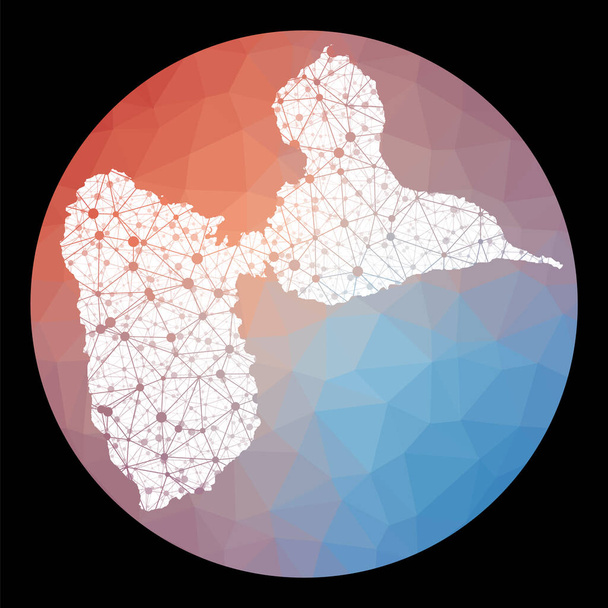
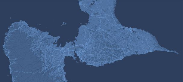
Vector network Basse-Terre Island map. Map of the island with low poly background. Rounded Basse-Terre Island illustration in technology, internet, network, telecommunication concept style.

Colorful houses. Background with cute buildings on beige, blue and orange colors. Vector illustration.
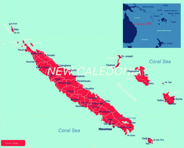
"New Caledonia detailed editable map"
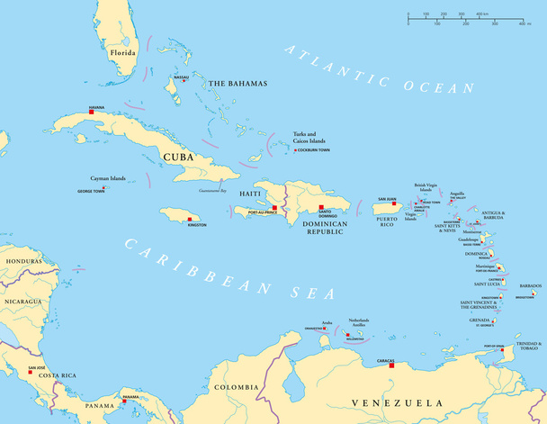
Political map of the Caribbean - Large and Lesser Antilles - with their capitals, national borders, rivers and lakes. Vector illustration with english labeling and scale.

Background with cute buildings on gray, brown and neutral colors. Colorful houses. Vector illustration.
Hommes et femmes qui se tiennent la main autour de la Terre avec logo colombe de la paix et couleurs ukrainiennes au dessous

White and grey horizontal map of Guadeloupe, Caribbean islands. Archipelago and overseas department and region of France. Urban area cityscape vector illustration.

Vigo County, Indiana (U.S. county, United States of America, USA, U.S., US) map vector illustration, scribble sketch Vigo map

Liguria and the Italian Riviera, the Ligurian Riviera, political map. Region of north-western Italy, with capital Genoa. A narrow coastal strip between Ventimiglia and La Spezia, on the Ligurian Sea.